


Data from the international Surface Water and Ocean Topography mission helped researchers to calculate the depth of water in this transient freshwater body.
California’s Death Valley, the driest place in North America, has hosted an ephemeral lake since late 2023. A NASA-led analysis recently calculated water depths in the temporary lake over several weeks in February and March 2024, demonstrating the capabilities of the U.S.-French Surface Water and Ocean Topography (SWOT) satellite, which launched in December 2022.
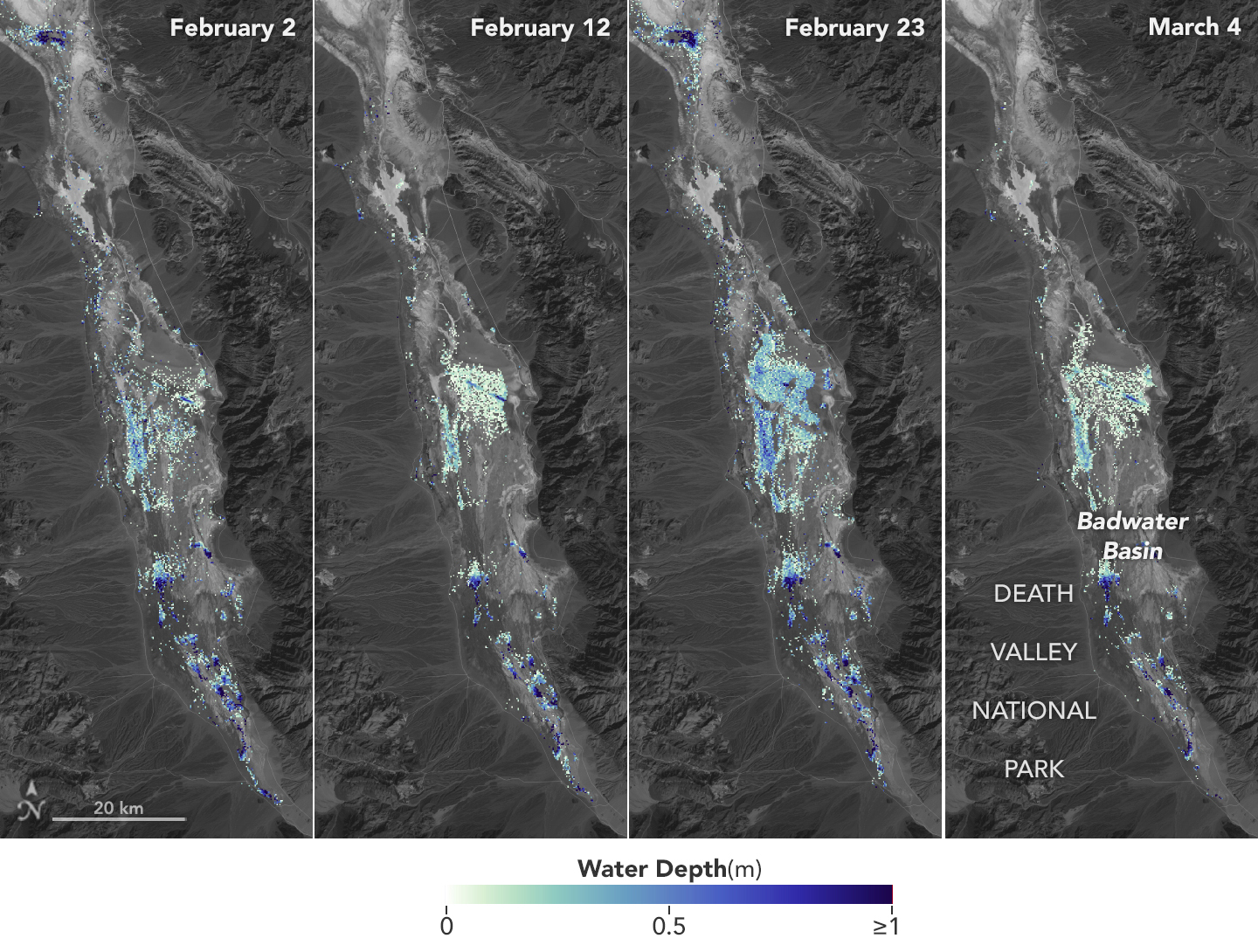
The analysis found that water depths in the lake ranged from about 3 feet (1 meter) to less than 1.5 feet (0.5 meters) over the course of about 6 weeks. This period included a series of storms that swept across California, bringing record amounts of rainfall.
To estimate the depth of the lake, known informally as Lake Manly, researchers used water level data collected by SWOT and subtracted corresponding U.S. Geological Survey land elevation information for Badwater Basin.
The researchers found that the water levels varied across space and time in the roughly 10-day period between SWOT observations. In the visualization above, water depths of about 3 feet (1 meter) appear dark blue; those of less than 1.5 feet (0.5 meters) appear light yellow. Right after a series of storms in early February, the temporary lake was about 6 miles (10 kilometers) long and 3 miles (5 kilometers) wide. Each pixel in the image represents an area that is about 330 feet by 330 feet (100 meters by 100 meters).
“This is a really cool example of how SWOT can track how unique lake systems work,” said Tamlin Pavelsky, the NASA freshwater science lead for SWOT and a hydrologist at the University of North Carolina, Chapel Hill.
Unlike many lakes around the world, Death Valley’s lake is temporary, relatively shallow, and strong winds are enough to move the freshwater body a couple of miles, as happened from Feb. 29 to March 2. Since there isn’t typically water in Badwater Basin, researchers don’t have permanent instruments in place for studying water in this area. SWOT can fill the data gap for when places like this, and others around the world, become inundated.
Since shortly after launch, SWOT has been measuring the height of nearly all water on Earth’s surface, developing one of the most detailed and comprehensive views of the planet’s oceans and freshwater lakes and rivers. Not only can the satellite detect the extent of water, as other satellites can, but SWOT is also able to measure water surface levels. Combined with other types of information, SWOT measurements can yield water depth data for inland features like lakes and rivers.
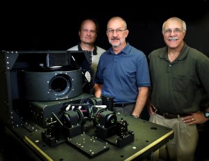
The SWOT science team makes its measurements using the Ka-band Radar Interferometer (KaRIn) instrument. With two antennas spread 33 feet (10 meters) apart on a boom, KaRIn produces a pair of data swaths as it circles the globe, bouncing radar pulses off water surfaces to collect surface-height information.
“We’ve never flown a Ka-band radar like the KaRIn instrument on a satellite before,” said Pavelsky, so the data represented by the graphic above is also important for scientists and engineers to better understand how this kind of radar works from orbit.
More About the Mission
Launched in December 2022 from Vandenberg Space Force Base in central California, SWOT is now in its operations phase, collecting data that will be used for research and other purposes.
SWOT was jointly developed by NASA and the French space agency, CNES (Centre National d’Études Spatiales), with contributions from the Canadian Space Agency (CSA) and the UK Space Agency. NASA’s Jet Propulsion Laboratory, which is managed for the agency by Caltech in Pasadena, California, leads the U.S. component of the project. For the flight system payload, NASA provided the KaRIn instrument, a GPS science receiver, a laser retroreflector, a two-beam microwave radiometer, and NASA instrument operations. CNES provided the Doppler Orbitography and Radioposition Integrated by Satellite (DORIS) system, the dual frequency Poseidon altimeter (developed by Thales Alenia Space), the KaRIn radio-frequency subsystem (together with Thales Alenia Space and with support from the UK Space Agency), the satellite platform, and ground operations. CSA provided the KaRIn high-power transmitter assembly. NASA provided the launch vehicle and the agency’s Launch Services Program, based at Kennedy Space Center, managed the associated launch services.
To learn more about SWOT, visit:
News Media Contacts
Jane J. Lee / Andrew Wang
Jet Propulsion Laboratory, Pasadena, Calif.
818-354-0307 / 626-379-6874
jane.j.lee@jpl.nasa.gov / andrew.wang@jpl.nasa.gov
2024-043